Masonry is one of the oldest businesses in human history. But there’s more to it than laying bricks and creating stone facades. There’s the business end of it, and businesses today want any advantage they can get. They want to stand apart from the competition. How do you do that when all a client sees is a bunch of rocks and mortar? You reach for technology.
Our January 2017 issue brought a taste of that by discussing drones.
While we had fun bringing you that story about the various types of drones available and the tricks they can do, they’ve developed a lot in the year since that article. Now it’s time to explore an example of drone software platform. This is just the ticket to help you stand apart from competition— not just because you’ve got the coolest tool on the jobsite but because of the unique benefits you can now give clients that would have been cost-prohibitive or downright impossible before. (See “Drones,” January 2017 issue).
Drones are a lot safer than having crew members climb steep ladders or scale walls in an attempt to cover more than the ground-angle of a project. They can capture as-builts for documentation and renovation. They can also more safely and easily measure quantities of materials needed by photographing an entire site, especially in sites not easily accessible without liability issues. OK, you say, you already know that. So tell me something more, you say.
Improve Workflows and Accurate Deliverables
Consider Site Scan. This drone-mapping software from Berkeley, Calif.-based 3DR helps mason contractors improve collaboration with their teams and designers and clients, all the while smoothing out workflows and creating highly accurate deliverables. From before the bid to after the last brick is placed, it’s useful for drone-adopting masons. (Site Scan even has a practice test for those studying Part 107, the FAA’s Remote Pilot Certificate exam, to fly commercial drones.) Many other players have already begun to use it and immediately started gaining more opportunities and winning more projects.
Launched in spring 2016, Site Scan is a complete drone platform, combining the drone itself, analytics software, and enterprise-ready support. 3DR provides onboarding, education, and assistance for Site Scan customers.
“Site Scan users can now use DJI drones to convert images into actionable data that helps project stakeholders save time and manage costs,” said Michael Perry, Director of Strategic Partnerships at DJI.
The software takes drones to a whole new level. Users have yielded a demonstrable ROI through using the platform. Companies in a range of sizes— from two-person survey crews to the likes of PCL Construction, McKim & Creed, and Kimley-Horn say they find the platform easy because it’s scalable and meets their demands for a smooth, efficient workflow in the field.
Using commercial-grade drones, customers get high-resolution imagery, which is especially important considering the need for fine detail rather than simply large images. It’s data though, not the video that really drives the ROI of drones: Site Scan exports native Autodesk file formats that can be easily brought into the tools you use every day.
Let’s consider the workflow. Just as last year’s article detailed, having a camera with a lot of capacity and a drone with a long run-time means you won’t have to frequently bring the drone down to download from a camera that’s quick to fill up or to replenish batteries quick to empty.
How it works
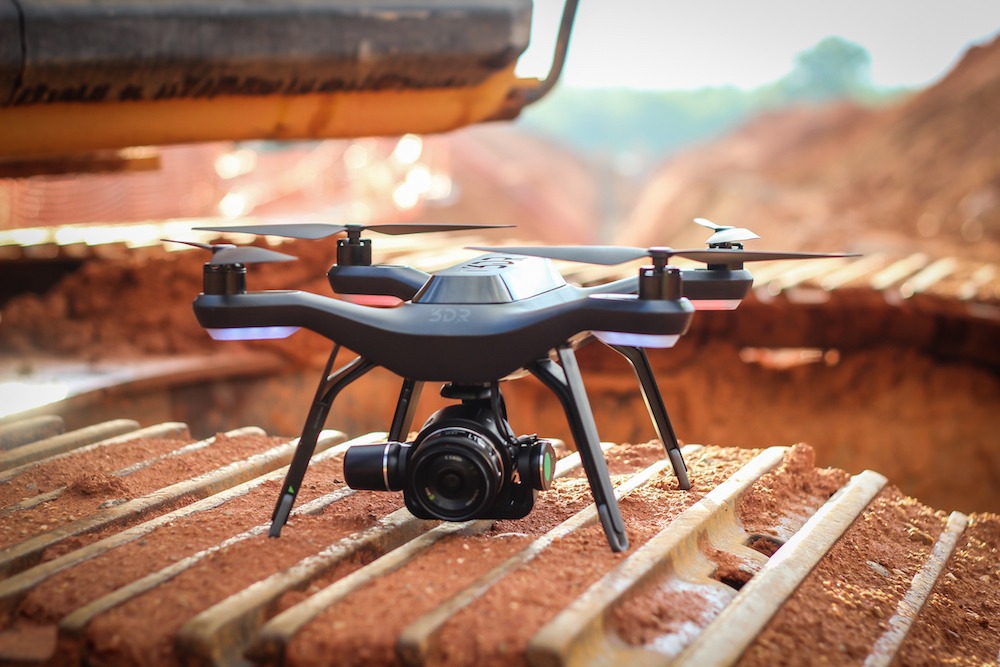
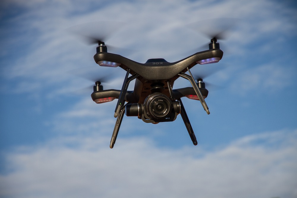
Site Scan is hardware independent: customers can use the 3DR drone, though the platform integrates seamlessly with DJI drones like the Phantom 4 Pro, too. Both 3DR and DJI drones would be suitable for masonry projects.
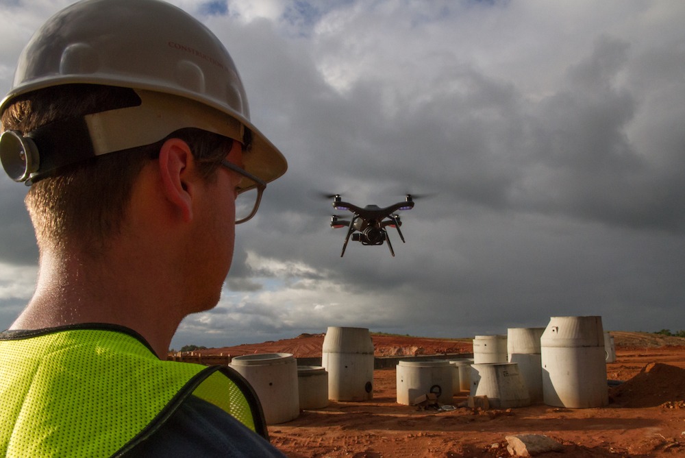
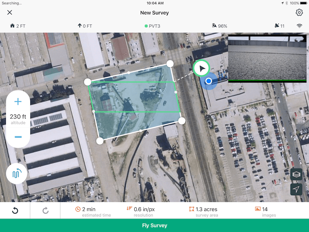
Now that you’ve got your drone and earned UAV certification, the first real step in any project is mission planning. This is when Site Scan starts to show off how it smoothes workflows. What used to take days now takes hours. Use Site Scan’s Field app to draw a polygon over the site area you want to map and the software automatically creates the flight path that most effectively covers the area.
The second step is a flight survey. During this step the app goes through a preflight checklist to ensure a safe takeoff and flight. Afterward, the drone takes off and flies the predetermined path without the need for manual operation. Just set it and let it go. This is one of the most obvious advantages of the Site Scan platform, though it is important to keep an eye out because wind, rain, and radio waves can still cause interference.
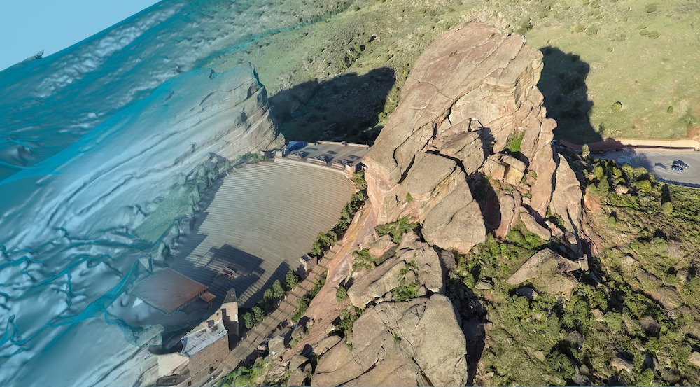
Once the drone completes the flight, it wirelessly uploads the images to the Site Scan cloud, where they are then processed in photogrammetry engines like Autodesk ReCap and Pix4D, turned into orthomosaics, point clouds, and other data products.
Seamless delivery
Within just a few hours the processed data is available for viewing through Site Scan Manager. Now you can send the images and orthomosaic to stakeholders through a public link, as easy as it is in Dropbox or GoogleDocs. There are several file formats available to export:
- Ortho (orthorectified georeferenced image and raster DEM)
- RCM (ReCap 3D mesh)
- RCS (ReCap point cloud)
- FBX (Autodesk 3D mesh)
- OBJ (Open-source 3D mesh)
- LAS (Open-source point cloud)
Real life examples
Let’s look into some real-life examples. One case study describes how PCL Construction Orlando used Site Scan in early 2017 on a 7.5-acre crystal lagoon project, a site planned for 3,000 homes near Tampa. Normally, PCL would take a week to perform a traditional survey, process its data, and finalize the PDF, CAD file, and contours. Using the Site Scan platform, however, the company shrunk that time to just a day and a half.

That allowed for far better quality control on the ground.
Then there’s the example of Bogh Engineering. The Beaumont, Calif.-based firm was working on a school construction project that required surveys after every major milestone. That meant their surveyor had to walk the 17-acre site and measure 324 points in the field, which took a day or two. Processing the data took another day. Using the Site Scan drone platform, Bogh’s surveys and processing now take half a day. That’s a total time-saver of four times.
It’s not just builders and engineers who are seeing the benefits of grabbing technology by the remote control. “Site Scan certainly has and can be used for stone, brick, and concrete projects,” says Hugh McFall, Product Marketing Manager at 3DR. “You need proper documentation of your jobsite, especially if you’re pouring concrete or laying brick. The aerial view of a drone—which creates orthomosaics that you can track over time—makes this easier than ever before.”
They can be used on masonry projects to capture the existing conditions of the site, grant more QA/QC to a project and the performed work, share updates with clients, and document the site at key milestones. They do this at a fraction of the time and cost of traditional alternatives, while helping reduce risk and improve safety on-site.
Considering the gravity of the fact these drone images will become data that affects many people and has a monetary impact, it’s important to choose the right drone. While users have as many different needs as there are drones, some imperative criteria to use in selecting a drone are these:
- Resolution (ground sampling distance),
- Sensor size of the camera,
- And image lens distortion. (A lot of cameras produce fish-eye images, which could distort data so it’s important to get the right quality.)
- Which software tools you use daily. (Drone data must be able to fit in those formats.)
Working with BIM
It’s the tools you use daily that give 3DR’s Site Scan platform another tremendous benefit. 3DR has integrated with BIM 360, the leading project management tool for virtual construction managers and field teams, through the Autodesk Forge platform. This allows entire project teams including project managers, engineers, subcontractors, superintendents, etc. to access and incorporate drone data in their day-to-day work. Here are some of the ways that happens:
- Users can overlay up-to-date design files. They can pull CAD and PDF design files from BIM 360 into Site Scan and overlay them onto orthomosaics, allowing for easy comparisons between design and reality, spotting any mistakes in real time. When design files change in BIM 360 they automatically update in Site Scan, giving crews increased confidence because they’re viewing the most up-to-date overlays.
- Having Site Scan drone data such as orthomosaics, point clouds, and digital elevation models in a BIM 360 account makes it easily accessible in Revit, BIM 360 Glue, and Site Scan’s Field.
- It’s easy to spot jobsite problems. Create an issue directly on your orthomosaic in Site Scan and push it to BIM 360 Field, facilitating collaboration between field personnel to quickly resolve issues.
Accuracy
Inaccuracy can throw a monkey wrench in any project— and often does. On each site too accuracy levels vary. Site Scan therefore divides data accuracy into two factors: absolute and relative. “Absolute accuracy,” according to a 3DR e-booklet, “measures the degree to which a point on your drone map compares to the same point in the real world.” Relative accuracy, on the other hand, measures how accurate a point on your map is when compared to other points.
A few factors influence accuracy:
Camera sensor size— Site Scan has a Sony R10C with a 20.1MP camera, which is one of the best in the sky. “The better the camera, the better deliverables you’ll be able to create,” McFall says.
Flight altitude— “The lower you fly, the better the results,” he says.
Georeferencing with ground control— This point helps lend accuracy, as does a photogrammetry processing engine. “We have multi-engine processing with Pix4D and Autodesk ReCap.”
To glean further insight into how these factors play out, Banner Associates, an architecture, engineering, and licensed land surveying consulting firm based in South Dakota, collaborated with 3DR on a study. The case study also reveals a bit more about how the Site Scan drone platform works. For instance, in the study the drone flew at an altitude of 150 ft., a common altitude for drones used in surveying, engineering, and construction projects. It captured 288 high-resolution photos over 17.6 acres using one battery. Flight time was approximately 12 minutes.
For the georeferencing workflow Banner set eleven ground control points on-site. Nine were used as true ground control points, and the other two served as checkpoints to independently validate accuracy. Banner’s field tester then uploaded all 288 photos to the Site Scan cloud and georeferenced them using Site Scan’s in-browser ground control point workflow. He tagged each of the 11 ground control points with at least five different images from the surrounding area, using the two checkpoints too. Then he processed the images by the Pix4D engine into photogrammetric data products, which brought about an orthomosaic, digital surface model, point cloud, and 3D mesh. Forty minutes and seven seconds later, these products were processed and ready for use in Site Scan Manager, a web app.
In the end, the Banner study found 3DR Site Scan’s deliverables— orthomosaics, point clouds, etc.— were horizontally accurate within 0.0319 ft. and vertically accurate within 0.0382 ft.
Bottom line
In multiple ways this article has revealed how much time and labor the Site Scan platform can save you and your clients. It’s not just about saving money, though. This is the age of big data and those who know how to use that data will emerge victorious. Making this data available throughout your organization can open unforeseeable avenues. Firms of various types throughout the building industry claim they’re also winning more bids. Site Scan had helped them stand apart from their competitors, competition that’s still afraid to adopt technology until they see their lack of embrace affecting the bottom line.
Having this data grants Site Scan’s users benefits from before the bid. Having enriched insight into the existing conditions of the project site helps determine more accurate labor and material needs. Using drones also prevents liability risks of having laborers climb up steep ladders, on rooftops, through windows, and otherwise risk life and limb trying to get photos of buildings by hand, then bring those camera back to work, having to remember which photos show what, and still not seeing the whole site and its features and nooks and crannies well enough to gain such accuracy as this platform offers. Therefore, we could extrapolate that to mean that it eliminates surprises along the way too.
Platforms like this continue to prove beneficial as a project progresses. Images captured just before a client meeting grant a dynamic, comprehensive view of the project’s progress as close to real time as it gets without walking the site. Not having a physical meeting? Sharing images happens as easily as one click on a link that can be easily shared with clients and owners. This kind of detail about project progress makes clients feel more at ease. Isn’t that worth looking into if it leads to a repeat client?
More than that, though, it is yet another way optimizing this software helps a bid stand out from the others: it allows you to take a final 3D as-built of the finished project which can be given to clients to help them determining their washing, tuckpointing, renovations, or other project needs later.
Costs
Drones and this kind of platform are changing the industry seemingly overnight. A number of trades in the building industry are opting for a safer, quicker means of gathering and processing data, and significantly improving their bottom line by being better able to accurately manage projects and have a smooth workflow. Drones quickly became crucial on job sites of most every type and platforms like Site Scan are showing a quick, high ROI.
Costs range for products like this. Site Scan costs approximately $12,000 for an annual license of the full solution: drone, software platform (mobile and web app), and success services; $8,700 for software and success services, if you use your own drone. Others run up to $30,000. Do your research and then do yourself a favor. Get on board the drone trend, secure a place apart from the competition, gain repeat clients, and start saving on labor and materials costs in the process. Then send us your success stories.